check in for news and updates on our activities
30th August 2022
We're pleased to have completed a 42km2 RGB and LiDAR plane survey for an onshore windfarm client near Inverary, Scotland.
The project involved collecting ultra-high resolution imagery (5cm GSD) and classified LiDAR point cloud, to aid with the development of the Section 36 application.
The post-processed products (orthomosaic, 3D point cloud, DTM/DSM, Topographic Survey) constitute a highly cost-effective alternative to terrestrial based topographic surveys.

15th January 2022
Following the successful delivery of a 73km2 RGB and LiDAR plane survey for an onshore windfarm in Ayrshire, Scotland, Summit Geo provided high resolution terrain and vegetation models to the clients energy yield consultants, taking into account 1 and 10 year growth scenarious for a commercial coniferous plantation within the wind farm site.

1st April 2021
We are proud to have just completed a three-phase pre/post aerial survey run for the Highways England A417 road diversion project, in partnership with ARUP.
The project involved collecting ultra-high resolution imagery (1.7cm GSD for the 20km2 study area), before, during and after the archaeological survey campaign. The post-processed products (orthomosaic, 3D point cloud, DTM/DSM, Tiled 3D model) constitute an invaluable snapshot of ground conditions that can geospatially de-risk the project going forward.
23rd January 2021
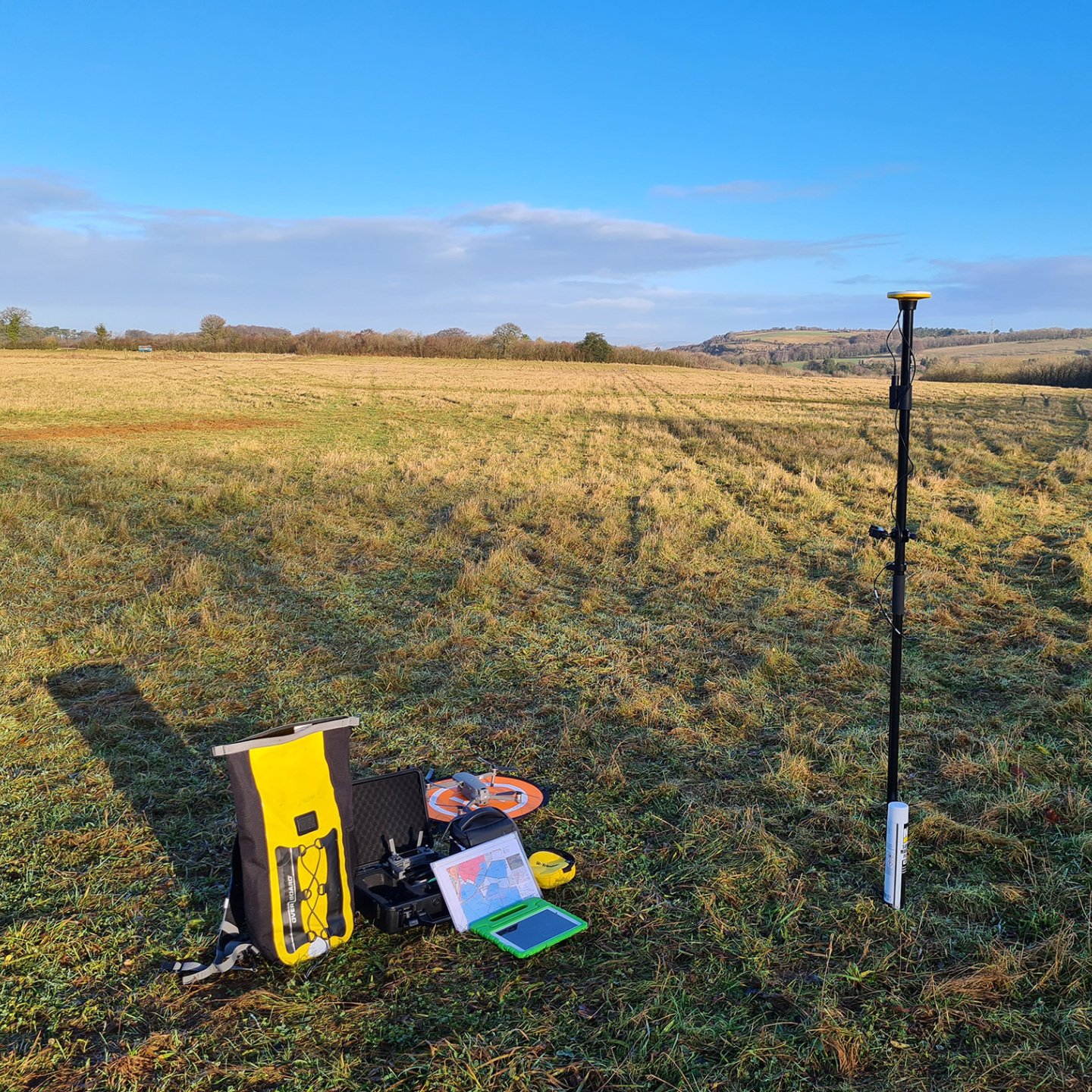
Another tricky survey day today, when your white GCPs occupy the same ground as snow and frost!
A good opportunity to get up and see the effects of archaeological survey trenches on the landscape, as you can see from the 360 pano below.
It takes a few moments at the end of the job, but getting a quick shot like this really helps the client get some added perspective on their job site.
16th January 2021
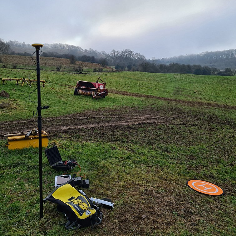
A touch and go day for an aerial survey today. Mist can often catch us out in cold weather, especially in hilly areas where it can appear from nowhere.
We make use of multiple weather forecasting models to ensure that time isn't wasted travelling to a site unecessarily. Sometimes you just need to turn up, fly to your survey height, and look down!
19th December 2020
A crisp day for some site monitoring (post-archaeological trenching).
Contrary to popular opinion; days like today are pretty tricky for photogrammetric surveying, as the shadows and constrasting light patterns can affect the output.
Always important to post-process the imagery back in the office to ensure consistency and quality.
28th November 2020
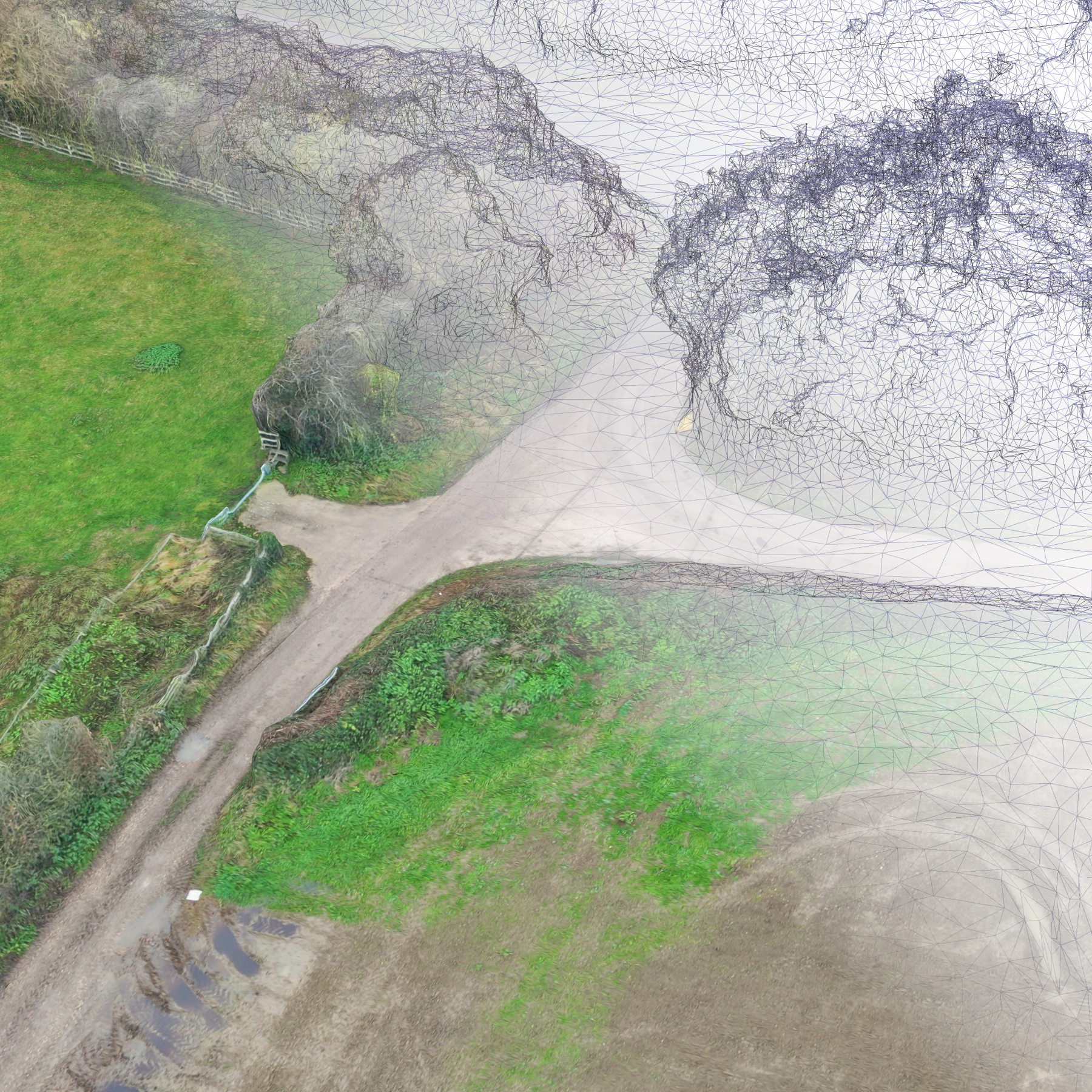
Under all that ultra-high res texture, you've got a mesh model that can often be underestimated by the client (from a recent road diversion survey). It's common to have requests for a "TIN" (Triangulated irregular network) or a "Terrain Mesh". But those terrain models are a totally different product to the mesh below. Summit Geo will always discuss the client's requirements, in detail, to ensure that all deliverables and file formats are what the customer expects.
17th October 2020
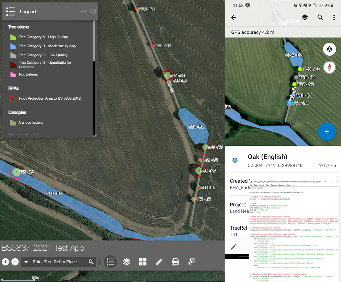
Work underway on our BS5837 Tree Survey Toolbox.
Our client Barton-Hyett Associates is using cutting edge data collection tools to provide a more dynamic, accurate and concise package to their clients. Using ArcGIS Collector and high-accuracy GNSS, they are collecting sub-metre tree survey locations and bringing the conventional BS5837 survey online. All ther work is backed up to the cloud and their offline workflows are synchronised when they're back on Wi-Fi or 4G.
Summit Geo support Barton-Hyett with their GIS requirements across the ESRI stack, and we are integrating their surveys with private and public facing web applications.
Below's example is our latest tool that converts their survey data into BS5837 canopies, route protection areas and styles, which can either be exported to PDF or viewed in a web application.


